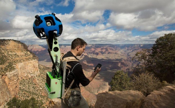
 Google Maps in the Grand Canyon
It seems, that the status of a global technology leader still isn't as high as Google want to obtain. Almost every day this significant corporation, better-known for its Internet search engine, presents more and more new projects. One of its revenue sections is Google Maps. So, as you might have already guessed, this article will be again devoted to Google on-line maps' expansion.
On Wednesday, apparently willing to provide the users with a chance to explore all the nooks and crannies of the planet, Google Maps Team went to traverse the Grand Canyon. Fitted with the Trekker, specially designed backpack with a camera system on top, Google Team was aimed to capture 360-degree photos, depicting the rocky landscapes, previously untouched by cars, trikes or snowmobiles.
The point is that, this wearable device Trekker empowers to take pictures while its user walks. That's why this newest camera system is perfect for such photo sessions in hard-to-get places.
This collection of the Grand Canyon panoramic views is to supplement the explored views of other magnificent places as the Swiss Alps, the Amazon or Antarctica. “These panoramic views will soon be live on Google Maps, giving everyone from real-life visitors to armchair travelers the opportunity to marvel at this beautiful, majestic site from the comfort of their computers or mobile devices”, says Ryan Falor in the official blog.
 Google Team hiking the Bright Angel Trail on the South Rim with Trekkers
Well, I feel you will agree, that Google' striving for innovations and perfect applications (for instance, the above-mentioned on-line maps) is getting quite unthinkable. Of course, that's all very well, but what if this Google's wish to be at all times and in all places carries to the point of absurdity? I mean, imagine one day you'll find Google Maps Team in your house, taking pictures of your private surroundings, will it be OK? They 'just want to create the most comprehensive map in the world'. Sure.


